CommunityScale and Bridle Design (landscape and urban design) partnered with the Town of Natick to analyze and visualize a zoning proposal that reimagines the West Central Corridor, a key stretch of Route 135 extending from the Framingham line to Mill Street. This initiative was successful in communicating the vision and adopting the zoning. The zoning represents a strategic approach to reform that balances growth opportunities with community character, creating a framework for sustainable mixed-use development along this important gateway corridor.
Understanding the Challenge
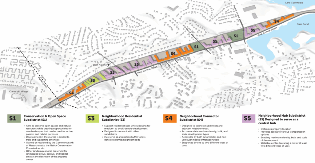
The West Central Corridor presented unique opportunities and complexities. This historic commercial strip started as lake houses and camp roads. Over time, it evolved into a mix of different uses including two-family homes, medical offices, junkyards, and affordable commercial spaces built in the 1960s and 70s. The challenge was to create a clear zoning framework that would encourage redevelopment while respecting the existing landscape and keeping housing affordable.
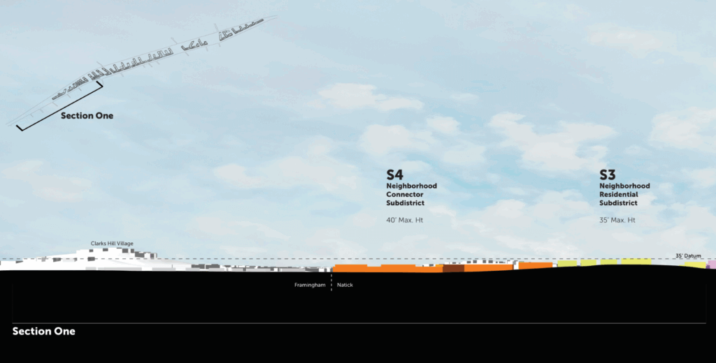
The corridor’s steep slopes and elevation changes along Route 135 required careful study. We needed to ensure that new development standards would create smooth transitions between properties and respect the residential neighborhoods to the north.
Strategic Analysis and Test Fits
CommunityScale began by analyzing the proposed rezoning and developing detailed test fit scenarios for buildout along the corridor. Our team created models that accounted for the complex relationship between Route 135’s elevation profile, individual parcel topography, and existing building heights.
These test fits went beyond simple massing studies. We calculated development potential for each parcel, generating figures for gross square footage, residential unit counts, and open space percentages. This detailed analysis allowed us to explore important tradeoffs in the proposed zoning, particularly around the balance between required affordable housing (set at 10% minimum) and open space provisions that could serve as offsets.
Visualizing the Future
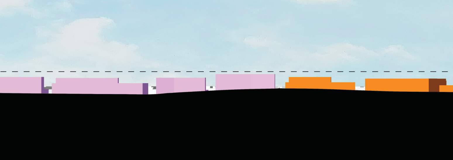
The centerpiece of our work was creating detailed drawings that showed the corridor’s transformation potential. Rather than abstract zoning maps, we developed section drawings that clearly communicated building types, character, and heights within the existing context. These visualizations helped residents understand how height limits would translate to actual development given the topography of the corridor.
Our drawings maintained a diagrammatic quality with softened edges, allowing for flexibility in implementation. We avoided prescriptive details about specific uses or architectural styles. Instead, we focused on form, scale, and relationships between buildings and open spaces. This approach encouraged community dialogue about possibilities rather than limiting future creativity.
Throughout the fall of 2025, CommunityScale worked closely with Town Staff to support for the adoption process. Our team managed the compressed timeline leading to October Town Meeting. We ensured materials met the warrant deadline while incorporating feedback from the Planning Board’s September hearings.
Creating Lasting Impact
The West Central Corridor rezoning establishes a foundation for transformation that extends beyond individual parcels. With the successful passage of the rezoning at Town Meeting, the West Central Corridor now has a clear framework for evolution. The new zoning eliminates confusion from multiple overlapping districts while providing predictable standards.